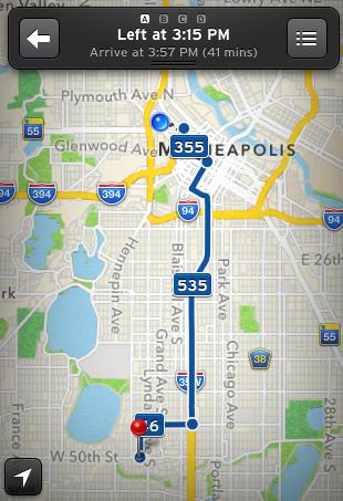
In addition to Metro Transit’s mobile website, the agency provides third-party developers the information they need to build apps that provide route and schedule information, frequently in real time. That trove of data comes primarily from The Minnesota Geospatial Commons, which collects GIS information from the seven-county metro region, and Metro Transit's real-time departure info system, NexTrip.
Standing at the corner of East Lake Street and Minnehaha Avenue and need to find a bus to Uptown? There’s an app for that. In fact, there are several.
Several developers have already put that data to use, creating apps that offer information about Metro Transit routes and schedules. The Pioneer Press has reviewed several available options; a complete list of apps with Metro Transit information can be found here.
Here’s a quick look at some of the available apps that could be of help to Metro Transit riders:
The Transit App. The Transit App automatically locates the nearest transit stop or can be used to find the nearest stop to a manually-entered address. After the stop has been identified, the app shows the next scheduled arrival and provides real-time information about the location of the bus or train. After entering a desired destination, the app can be used to get specific route information and to provide an estimated travel time. Free, iPhone, thetransitapp.com
HopStop. Like The Transit App, HopStop allows users to enter their location and preferred destination to find the nearest stops, routes and estimated travel times. The app also features full schedules and allows users to post live updates, adding a unique conversational element. Free. hopstop.com
Google Maps. Like its web-based bigger brother, Google’s map app automatically locates a user or allows a start address to be manually entered. Enter the final destination and select the bus icon to see what transit options are available. Free, iPhone, web. google.com
Twin Cities Tripr. The Tripr app allows users to search by route or stop and provides information about the next available local service or express bus. Information on Northstar, the Blue Line and the Red Line is also available. Free. iPhone. appannie.com
In addition to these apps, Metro Transit’s website is available in a web-friendly format. Simply enter metrotransit.org or metrotransit.org/mobile into your browser. The site allows users to view schedules, NexTrip (real-time departures), plan trips and locate service. On GPS-enabled devices, the “Find Me” feature can also be used to determine your location with just a touch.
Twin Cities Transit and mspbus.org also serve mobile web users.